

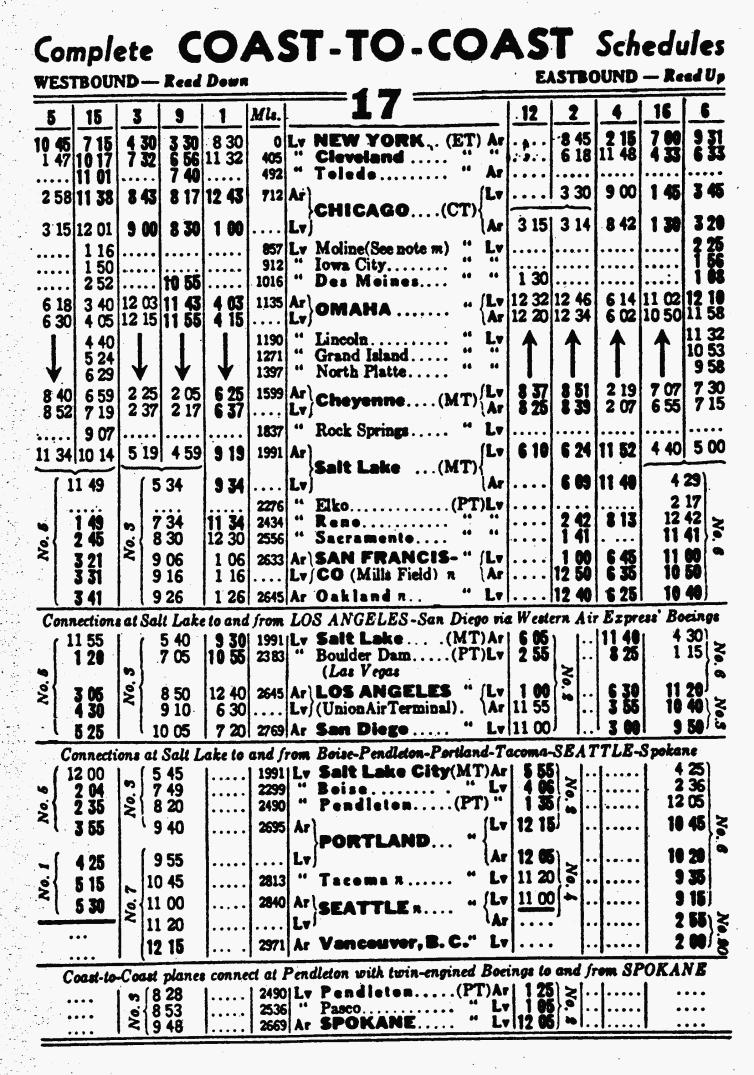
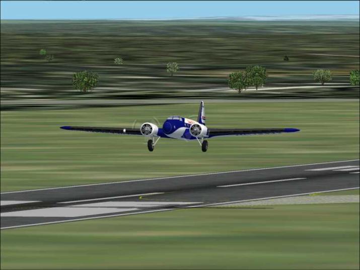
For June 2003 we are recreating the United Airlines New York-Oakland CA Route using Boeing 247D’s
The Boeing 247D for FS2002 is available at avsim.com. A panel and sound download is available here. As of 05-17-03 an updated aircraft.cfg which will have ATC calling you “United” “1” or whichever flight number you enter, and an updated panel.cfg can be downloaded here b247d_51703.zip The update is included in any panel and sound downloaded after that date.
Landing is difficult as compared to Lockheed Electra. The Boeing didn’t have any flaps. Here are the remarks of the designer of the FS2002 models flight dynamics FSAviator:
The most unusual aspect of the Boeing 247 was the
decision to provide low speed lift via a huge wing without flaps. The 247D has
very low profile drag compared to other aircraft of the day and in reality the
more Boeing reduced the drag by introducing new concepts like NACA cowls the
more it needed those missing flaps. It is essential to reduce speed early to
allow the deliberately low aspect ratio wing to produce induced drag. If you do
not it will float down the approach and then on down the runway. If you are not
used to flying flapless approaches you may find speed control difficult. The
problem is however accurately portrayed.
This aircraft was not designed to fly a three degree
glidepath under power. It is from a previous era of different techniques. You
must reduce to 80 KIAS before beginning final descent much of which will be
flown with throttles in flight idle. Reducing to 80 KIAS may take some time and
you should plan your circuit or IFR approach accordingly. Plan your turn onto
final so that it is flown at not less than 90 KIAS with time to reduce to 80
KIAS before intercepting the glidepath. Once established on the glidepath
speeds down to 70 KIAS are safe, but with no flaps to modify the wing camber,
(with an accurate panel.cfg), you will lose sight of your touchdown point as
AoA increases. If you are not used to flying flapless approaches you will make
the mistake of pushing the nose down. If you have judged your approach
correctly your touchdown point will re-appear as you sink below the glidepath
in a nose up attitude with some distance to run. Then, and only then, you can
increase power and IAS to keep the touchdown point in sight. If you lose sight
of the far end of the runway you are too slow or too high, or both, to complete
the approach safely. Resist any temptation to sideslip an aircraft as big as
the Boeing 247. It will not work well in FS2002 anyway.
Failure to control airspeed prior to final descent is the
greatest problem you will face when learning to fly the Boeing 247. Give
yourself lots of room and lots of time when setting up the approach. Those who
flew it in real life had rarely flown an aircraft with flaps and were used to
using induced drag from low aspect ratio wings to control descent rate.
Do not attempt to three point an airliner. The stalling
angle is much greater than the tail down angle and you will suffer a tail
strike. I have been very generous with the strength of the tailwheel, but
taildragging airliners must be 'wheeled on'. Aim to put the mainwheels down at
just under 70 KIAS, remove any remaining power and when below stalling speed
pull the yoke full aft and apply the brakes.
Note that full emergency power is not normally used for take off in the Wasp. The 247D can easily take off from any runway it can realistically land on. The power surplus is so great, and the acceleration after take off so good, that the usual Wasp transition through METO power (33/2100) is normally omitted, power being reduced immediately from normal take off (34/2100) to continuous climb (31/2100). Setting 2100 for take off gives you one less variable to change as you climb away. Go around is however performed at 35.5/2200 (full throttle / fully fine).
Aircraft by Dee Waldron
Flight Dynamics by FSAviator
So we are off!
We will depart New York (Newark (KEWR+) at 8:30am for the 405 mile
flight to Cleveland (Municipal (KCLE)).
The year is 1935 and we will be traversing the “Hell Stretch of the
Alleghenies” where so many of the pioneer air mail pilots lost their
lives. Hard to imagine that only 5
years ago, airliners where prohibited from flying this route at nite. In 1935 we have radio direction beacons to
guide us on our way. (The beacons I created are not historically accurate. They are Long Range NDB’s with up to 255nm
range.) Click here to download
the NDB’s Unzip into your main Fs2002 folder.
|
City |
FS2002 Airport
Code |
Altitude |
NDB |
Distance |
Course to fly |
|
Newark |
KEWR |
18’ |
801.0 |
|
|
|
Cleveland |
KCLE |
791’ |
802.0 |
350nm |
286 deg |
|
Chicago |
KMDW |
620’ |
803.0 |
266nm |
278 deg |
|
Omaha |
KOMA |
985’ |
804.0 |
365nm |
261 deg |
|
Lincoln |
KLNK |
1217’ |
805.0 |
47nm |
229 deg |
|
Grand Island |
KGRI |
1843’ |
806.0 |
70nm |
269 deg |
|
North Platte |
KLBF |
2778’ |
807.0 |
107nm |
266 deg |
|
Cheyenne |
KCYS |
6154’ |
808.0 |
186nm |
261 deg |
|
Rock Springs |
KRKS |
6578’ |
809.0 |
210nm |
Read text |
|
Salt Lake City |
U42 |
4599’ |
810.0 |
154nm |
Read text |
|
Elko |
KEKO |
5137’ |
811.0 |
180nm |
Read text |
|
Reno |
KRNO |
4409’ |
812.0 |
198nm |
231 deg |
|
Sacramento |
KSAC |
22’ |
813.0 |
103nm |
217 deg |
|
San Francisco |
KSFO |
9’ |
814.0 |
70nm |
201 deg |
|
Oakland |
KOAK |
3’ |
815.0 |
14nm |
46 deg |
Although our aircraft is
capable of rapid climbs, keep in mind that this aircraft is unpressurized and
keep the climbs down to 500-700fpm and the descents to 500fpm. The mountains in our path range up just a
bit over 3,000’ Lets plan our flight
for 8,500’, but we could fly VFR at 4,500’ or 6,500’ if the winds are more
favorable.
About half way we will
pass over Bellefonte Pa, an intermediate stop for the air mail pilots. Our destination is Cleveland Municipal airport now known as Cleveland
Hopkins Intl. Track the Newark NDB
outbound at 286 degrees When passing
Bellefonte tune in the Cleveland NDB and track inbound. I flew at 8,500’ until over Grove City PA (I
was a bit south of the course) I descended to 3,000’. When the downtown Cleveland skyline was just ahead to my right I
began my final descent. I controlled
the airspeed with throttle and let the gear down early to slow to less than
100kts. I didn’t have any difficulty
slowing to 80kts and touchdown at about 70kts.
Arrived at the gate at 11:05am.
We are due to leave
Cleveland (KCLE)at 11:32am (ET) and
arrive in Chicago (Midway (KMDW)) at 12:43pm (CT) The distance is 266 nm
and the course is 278 degrees. I flew
it at 6,500’ tracking the 802.0 CLE NDB until passing over Bryan OH (Williams
County Field). Then I switched to MDW
803.0. I arrived at Chicago at 12:37pm
(CT) All times are gate-to-gate and I am flew the first two legs with all
weather cleared. I flew the cruise with
25” map and 2000rpm. Climb was with
31”map and 2100rpm. Descent with 20”map
2000rpm.
Leave Chicago (KMDW) at 1:00
pm for the approximately 3 hour flight to Omaha’s Eppley Field (KOMA) In 1935 it was known as Municipal Airport. I flew at 8,500’ heading 261 deg tracking
outbound from 803.0 MDW Flying with
real weather. The winds varied from the
north to northeast, then after crossing the Mississippi from the west. Wind speeds were light, on the order of 5
knots. But they were enough to blow me
south of my course. I expected to cross
the mighty Miss at Davenport, but crossed south of the Quad Cities near
Muscatine.
About halfway to Omaha
(1hr 30min) I picked up the OMA NDB at 804.0 and adjusted my course to 270
degrees to track to Omaha. I arrived at the gate at 3:43pm. Anticipating headwinds I flew with power
settings of 28”map and 2100rpm. I burned 150gal of fuel. West of Des Moines I picked up mild
turbulence so I descended to 6,500’ and found smoother air.
Our passengers continue on
to the west coast, but we are going to spend the night here. In the morning you have the option of leaving at 4:05am with the local which makes
6 hops between Omaha and Salt Lake City, or at 6:30am with the
Omaha-Cheyenne-Salt Lake City express flight.
I will fly the local. If you
choose the express fly direct to Grand Island heading 255 degrees 111nm and
then follow the navigation instructions for the local flight from there.
Lincoln (KLNK) is a
short 47nm flight with a course of 229
degrees. LNK NDB is 805.0 116.10 is 5
miles north of the field. Depart Lincoln at 4:40am I flew at 4,500’ arriving Lincoln at 4:36am used 22gal landed on
RW 35 left
From Lincoln to Grand
Island (KGRI) is 70nm at a course of 269 degrees. GRI NDB is 806.0 In modern
times, the airport at Grand Island is a popular refueling stop for cross
country corporate jet flights. Departed
Lincoln at 4:40am flew at 4,500’ arrived Grand Island at 5:22am used 30gal. Landed on RW4 (long taxi to terminal using
RW13 as taxiway)
From Grand Island to North
Platte, NE (KLBF) pilots didn’t need any navaids. The IFR rule “I follow railroads” applies. The Union Pacific mainline (and US30 the
Lincoln Highway) was easy to
follow. While the railroad is not
depicted in FS2002 you could follow I-80 for the 107 nm on a course of 266.
Departing Grand Island at 5:24 am with
real weather winds 72 at 15!. At 6,500’ I had a nice 14 knot tailwind. I picked up the LBF 807.0 as soon as I took
off. Payback time! Had to circle around
to land on Runway 12. Arrive North
Platte at 618am just as the sun was coming up. Used 44gal.
From North Platte to
Cheyenne, WY it is 186 nm on a course of 261
The Cheyenne VOR 113.10 (195nm range) is 3 miles north of the
field. Depart North Platte at 6:29 am
(CT)
Still using same weather
file so I’m using RW12. We will fly a
heading of 261 deg until picking up the CYS NDB 808.0 beacon. I climbed to 8,500’ and picked up the CYS
beacon in less than 15 minutes. We crossed into Mountain Time about 25min after
taking off. The winds aloft at this point were from 318 deg at 12 knots. I
passed just north of Sidney NE elev 4,311’
Although the terrain is rising, it appears pretty benign. No hint of the mountains ahead. Passed just
south of Kimball NE elev 4,924’ at 6:30am MT
That puts us just 50nm to Cheyenne.
I taxied to the gate at 659am right on time. Fuel use was 80 gal. That
left me with 94 gal in the tanks which were full (270g) when leaving
Omaha. Still no sign of mountains, but
I know they are ahead. (I am going to
add a radar altimeter to the panel).
The next leg will traverse mountainous terrain, and we will have to
divert from the most direct route to avoid the highest of them.
The terrain has been
climbing steadily since leaving Omaha at 980.
Lincoln is 1217’, Grand Island 1842’, North Platte 2,778’ and Cheyenne
is in the high country at 6,154’
We also crossed into the
Mountain Time zone on the last leg.
The first 3 legs from
Omaha can be flown at 4,500’ or higher, but the Cheyenne leg needs to be flown
at 8,500’
Leave Cheyenne at 719 am for the local or 8:52 am for the non-stop to Salt Lake City. The route will be the same except the non-stop will save the time of landing at Rock Springs.
From Cheyenne (KCYS) to Rock Springs (KRKS) RKS NDB is 809.0
Flying at 8,500’ we will fly the northern route to avoid the bigger
“hills” from Cheyenne fly direct to
Medicine Bow (elev 6,644’) 76 nm heading 293 deg Track outbound from CYS
NDB 808.0 We leave Cheyenne at
7:19am and climb to 8,500’ (fuel tanks are topped off at 270gal). About half way to Medicine Bow I notice some
trees on a ridge ahead. They seemed to
be at about my altitude. Make sure your
altimeter is set for the current barometric pressure (press b) and climb to
9,000’ The ridge is about 8,400’. After passing the ridge descend back to
8,500’. I picked up the RKS NDB before
I got to Medicine Bow (Medicine Bow is very hard to pick out from the air. I saw the VOR antenna about 13nm SE
easily.) At 7:52 am I turned to track
the RKS NDB hdg 250 deg According to my
charts its 130nm. We pass just south
of Rawlins WY (elev 6,811’) My winds aloft where from 261 deg at 16 knots
causing me to drift a little south of the desired track. So I adjusted my heading to 255 deg (right
of the ADF needle). Just west of
Rawlins I noticed that I had picked up I-80 (Union Pacific for you 1935
purists). Not much help, strains the
eyes to see it. Be nice if Microsoft
includes railroads or at least more visible roads in FS2004.
Arrived Rock Springs (elev
6,758) making a straight in approach to RW27.
Time at the gate was 9:04am Departed at 9:07am and climbed to 8,500’ and a heading of 238 deg
Picked up the Salt Lake
City 810.0 NDB about 10 miles out of Rock Springs. I track directly toward it
at a heading of 232 deg. South of Ft
Bridger the terrain seems to be climbing to meet me so I climb to 9,500’ (when you see individual trees in FS2002 you
are within 1,000’ of the ground). At
10:05 the mountains block my path, but I see I-80 beneath me so I turn right to
253 deg and follow it through a notch.
Straight ahead is downtown Salt Lake City. Municipal field (elev 4,999’) is 14nm at 220 deg. I begin my descent and turn to 210 deg. As I
arrive east of the field I am 1,200’ agl and turn downwind for RW34. I’m already late according to the
schedule! I turn base at 700’agl and
have the speed down to 80 knots. As I
turned final I am greeted with red VASI lights and trees that look too
close! Add some throttle and drag it on
in. Not a pretty landing. Arrive at the gate at 10:20am (6 min
late.) The flights to Los Angeles, San
Francisco and Seattle don’t depart for another 90 minutes so no one is
complaining. Used 64 gal of fuel. Have
112 gal left out of 270 on board when leaving Cheyenne. Next time I try this flight I’m going to fly
faster. I flew with 25”map and 2100
rpm. I’m going to spend 25 hrs laying
over in Salt Lake and will pick up with flight #5 to San Francisco tomorrow.
Depart Salt Lake City at
11:49am. Due to winds used RW 16 then
made a climbing right turn to 340 degrees.
Besides the mountains east of the city that we flew through on the last
leg, there are mountains southwest of the city. So we will fly north and climb to 8,500’. When we reach the Great Salt Lake we will
turn to 270 degrees until picking up the EKO NDB 811.0 I picked it up at about 20 min after taking
off at a bearing of 258 degrees. This
takes us across the Bonneville Salt Flats and over Wendover UT/NV where we
enter the Pacific Time Zone.
West of Wendover I crossed
a ridge that was about 7,300’ then at 12noon
PT (1:10 after takeoff I crossed a ridge that was about 7,600’. Another higher ridge (with peaks) was ahead
so I took a more northerly heading and flew around it. As I again began to track the EKO NDB at 253
deg I was about 25nm from Elko. As I
passed over the Elko (elev.5,137’) at 12:14pm I turned to 231 deg. At 12:25pm I picked up the RNO NDB
812.0 straight ahead (about 175nm away). At 12:33pm I turned right to 240 deg to go around
some high terrain. At 12:37pm I
turned back to track the NDB at 232 deg.
Not long after that, there was another ridge but I cleared it by almost
2,000’. Approaching Reno (elev 4,409’)
I encountered wind shift so I dropped down to 7,500’. Landing RW34L. Started my
left turn to downwind just 5nm from the airport so as to clear the high terrain
east of the field. Turned to base at
6,200’. The winds made for a dicey
landing. Taxied to the gate at 1:44pm
PT We are do to leave in 5 minutes
for Sacramento. Fuel used 152 gal. Next time I’ll turn off the weather and fly
straight in to RW25.
Pulled away from gate at 1:44pm
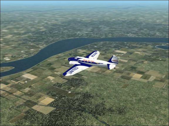
Took off on RW 16, climbing turn to 270 deg climbed to 8,500’. Found
I-80 (see picture) and followed it into mountains past Truckee.
Climbed to 10,000 and
tracked SAC NDB 813.0 hdg 217 deg.
After passing mountains descended to 6,500’, then 4,500’ and 2,500’ KSAC is elev 22’. Entered right downwind for RW2 at 1,500’ arrived at gate at 2:41pm used 40gal for this leg.
Departed Sacramento
Executive at 2:45pm climbing left turn to 201 deg leveled off at
2,500’. The SFO NDB 814.0 was active
after takeoff. Inbound to the bay I
received clearance to approach RW 28R so turned to 190 deg and flew directly
over Oakland on the approach. Arrived
at the gate at 3:24pm (3 minutes late)
Fuel used this leg was 28gal.
Departed San Francisco at 3:31pm
for the hop across the bay to Oakland
The 1935 Municpal field is the North Field of todays KOAK. Landed RW 27 L and taxied to the gate at
3:43pm fuel used this leg was
6gal. Fuel remaining from the 270 gal
in the tanks when leaving Salt Lake City was 48 gal. (Don’t bother contacting ATC as they will instruct you to land on
RW 29 at the new airport.
Hope you enjoy your
flights. Report them all to the
Northern Division. I will copy the
reports to your home division and to the Air Mail Division. United Air Lines Newark-Oakland is the 1934
AM-1 Route.
Capt. Bill
Just a reminder, that the reason we are re-creating historic airline flights, is that 2003 has been declared the “Centennial of Powered Flight” in honor of the Wright Brothers first flight on Dec 17, 1903.
Back to the main Bluegrass Airlines page