
January
2006
North
One
of my first flight simulator “games” was “Solo Flight” 1984 by Sid Meier and
Bill Stealy who formed Micro-Prose Software.
You
could fly in
The
top half of the screen was a spot view from the rear of the aircraft, and the
lower half of the screen was an instrument panel.
A
description of the game and a copy of the manual are on-line at:
http://www.the-underdogs.org/game.php?id=1008
Primative
flight sim? I
certainly enjoyed many hours flying around
This
months feature is flying the mail between several
airports in
I
used a Stinson SR-7 to which I added a VOR for navigation purposes.
|
Time |
Town |
Airport |
Code |
VOR or NDB |
Elevation |
Heading |
Distance |
|
12:00 noon |
|
|
KMWH |
115.0 |
1184’ |
286 |
10 nm |
|
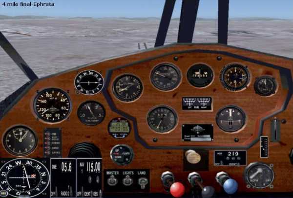
12:13/12:15 |
Ephrata |
Ephrata Mun. |
KEPH |
|
1276’ |
262 |
29 nm |
|
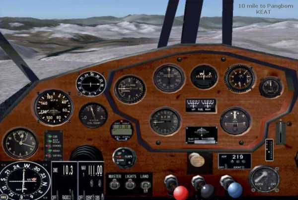
12:35/12:37 |
|
Pangborn Mem. |
KEAT |
111.0 |
1249’ |
003 |
16.2 nm |
|
12:53/12:55 |
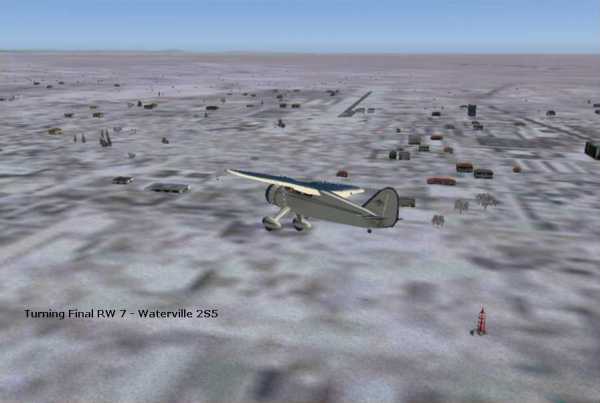
|
|
2S5 |
|
2641’ |
001 |
13.6 nm |
|
13:05/13:07 |
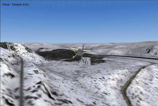
Chelan |
Chelan Mun. |
S10 |
|
1263’ |
85 |
12.8 nm |
|
13:18/13:20 |
|
|
8W3 |
|
2276’ |
347 |
39.6 nm |
|
13:46 |
Omak |
Omak |
KOMK |
219.0 |
1302’ |
|
|
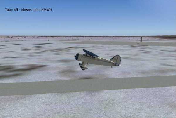
I
took off from KMWH at 12 noon, turned to 286 deg and climbed to 3,500’
Ephrata
was visible soon after take off and was an easy approach.
Pangborn came into sight after I cleared the high terrain to the east.
Taking
off from Pangborn I flew Northwest to follow the
river north until reaching enough altitude to clear the mountains. I then turned to 30 deg until intercepting
the
After
I cleared the high terrain, I saw the
Leaving
Taking
off to the north from Chelan I turned to 90 degrees and after clearing the high terrain began
my descent. As I intercepted the
outbound 20 deg radial from Wenatchee I turned left to line up for final at
Mansfield RW 3.
The
longest section is from
At
each airport I taxied to a hangar and dropped off two mail bags from
Now
I’m off for lunch and to make this web-page.
But you can take the 10 bags of mail you picked up back to
After
taking off track the 155 deg inbound radial to MWH VOR 115.00. The direct route is only 75 n. miles.